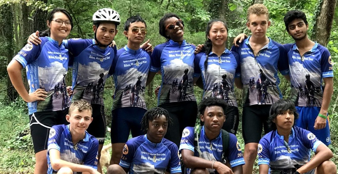
It didn’t take much for me to be hero for a day this past summer. My “hero-dom” was most likely because I never waver in my joy of adventure and self discovery.
From 2010 to now we’re taking African American, Latino, Karen, Chinese, Indian and Native American youth on biking adventures of over 700 miles linking history, social justice and community service under the Triangle Bikeworks’ program, Spoke’n Revolutions Youth Cycling.
The youth make visits to state and National Parks to speak with knowledgeable and enthusiastic park rangers. Pulling into small towns they meet local historians who work hard at keeping their history alive. Keeping Black history alive.
Our tour themes include:
- Underground Railroad
- Buffalo Soldiers/Lewis & Clark
- Blues & Jazz Tour
- Martin Luther King, Jr.
- Gullah Geechee culture
- Trail of Tears

With the 2018 environment and social justice themed, Bikes, Water & Soul! Students learned to be environmentally conscious and socially aware about environmental justice. It was on this tour that I was elevated from Coach to Hero in a moment’s notice.
The morning started the same as every morning with a slight difference. This morning we were leaving from a hotel instead of a campsite. The temperature was on the rise just the way it had been for the last nine days. I gathered the team underneath the hotel stairs to keep out of the sun.
“I’m very proud of you all. This is the start of our 10th day on tour. You’re all doing very well and we’re holding together as a team”, I began.
“Everyone checked out of their room and made a final sweep to make sure nothing was left?” Good. Today’s ride is going to be a short 43 mile day. We have the choice of riding on state highway 158W but I know how we hate to ride on the highways here so we’re going to ride through the Great Dismal Swamp. It’ll be a great ride because of its historical value. People escaping enslavement made it to the swamp to hide and were rarely followed there. That gave them one more step towards freedom,” I said.
I told them I did the normal research of using Google Maps to zoom in on the roads to ensure they aren’t gravel (because this happens often to our surprise). Zooming in only showed tree tops with a prominent line for a road straight through the Great Dismal Swamp.

Setting the bike GPS to the final destination was becoming increasingly problematic but I gave it one last try. The final destination was Merchants Millpond State Park. Our first rest stop, Paradise Family Grocery, was only 14 miles away. But with the final destination in the bike’s GPS, for some reason, it added additional miles and looped back on the routes. As a result I made a mistake and had the team continue when the names changed from Old US 17/Northside Road to State Highway 158W. The very road we were trying to avoid. Backtracking, we added five miles to the first rest stop. It should have been a warning sign but wrong turns happen all the time.
Leaving the rest stop we made our way to Horseshoe Road, crossing over Hwy 17 to quiet farmland roads. At the rest stop I made sure to change the bike GPS to our next break location for more accuracy. So far, we were right on course the sky was clear and the wind was in our faces. Everything was good under the sun.
After a few miles we were passing a 29 home sub-division. I’m wondering, “who would put this many houses this far in the cut?!”
We cycled up to a construction crew re-paving the road. The flag man smiled. After a minute or two we were allowed to continue. Looking down at the GPS our right turn onto Bull Boulevard Ditch was less than a quarter mile. But Horseshoe Road veered left. To the right is trees, bushes, overgrown weeds. Was the GPS acting up again? We continue left. I’m expecting the GPS to recalculate the route. With each revolution of the wheel it’s telling me how far off route we are. 93 feet, 150 feet, 1000 feet. We stop.
Reviewing Google Maps we could see that in a mile or two Horseshoe Road ended with little fanfare at a field of some crop or other. Itza, our Program Manager, went back to where we turned to check things out. While she was away thoughts of backtracking went through my head. It meant doubling back. Passed the houses in the middle of nowhere, back to the rest stop and onto the highway. Around the Great Dismal Swamp. Another 5 miles.
Itza called within 10 minutes to say that the road we’re looking for was back there but the sign was covered in weeds and branches. We were back on route.
We had to cross a pole gate. The big kind they use when they don’t want you to go there. We dragged our bikes under the big yellow gate and made our way into the swamp. The “road” that I saw on the map was a fire road.
To Be Continued…
